ラベル 特集号 の投稿を表示しています。 すべての投稿を表示

2021/05/01

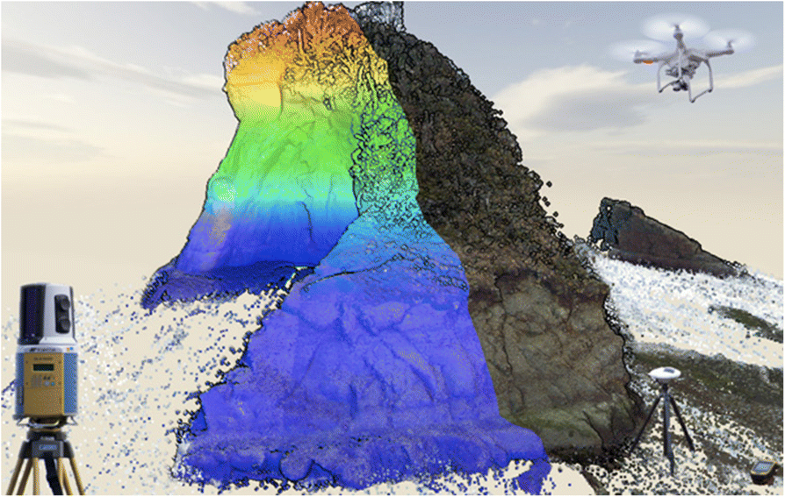
Sensors特集号 "Multi-Sensor Techniques for Topographic Mapping" 完了

 MDPI(Multidisciplinary Digital Publishing Institute)の発行する学術誌Sensorsにおいて、センシング技術と地形計測に関する特集号「地形計測のための複合的センシング技術」が刊行されました。

Special Issue "Multi-Sensor Techniques for Topographic Mapping"
Guest Editors: Yuichi S. Hayakawa, Hitoshi Saito, Kotaro Iizuka
https://www.mdpi.com/journal/sensors/special_issues/topographic_mapping

(募集時の記事はこちら:https://hdtopography.blogspot.com/2019/10/sensors-special-issue.html )

当初予定よりも時間がかかってしまいましたが、最終的に7篇の論文が採録されています。

オープンアクセスジャーナルなので、すべて無料で閲覧できます。

  • Sun, X. et al. (2021) Small All-Range Lidar for Asteroid and Comet Core Missions. Sensors, 21 (9), 3081. https://doi.org/10.3390/s21093081
  • Cooper, H. et al. (2021) Evaluating the Ability of Multi-Sensor Techniques to Capture Topographic Complexity. Sensors, 21 (6), 2105. https://doi.org/10.3390/s21062105
  • Balazs, M. et al. (2021) Quantifying Debris Flood Deposits in an Alaskan Fjord Using Multitemporal Digital Elevation Models. Sensors, 21 (6), 1966. https://doi.org/10.3390/s21061966
  • Bettiol, G.M. et al. (2021) Conformity of the NASADEM_HGT and ALOS AW3D30 DEM with the Altitude from the Brazilian Geodetic Reference Stations: A Case Study from Brazilian Cerrado. Sensors, 21 (9), 2935. https://doi.org/10.3390/s21092935
  • Mohammadi, A. et al. (2020) A Multi-Sensor Comparative Analysis on the Suitability of Generated DEM from Sentinel-1 SAR Interferometry Using Statistical and Hydrological Models. Sensors, 20 (24), 7214. https://doi.org/10.3390/s20247214
  • Obanawa, H. et al. (2020) Portable LiDAR-Based Method for Improvement of Grass Height Measurement Accuracy: Comparison with SfM Methods. Sensors, 20 (17), 4809. https://doi.org/10.3390/s20174809 
  • Hayakawa, Y.S. and Obanawa, H. (2020) Volumetric Change Detection in Bedrock Coastal Cliffs Using Terrestrial Laser Scanning and UAS-Based SfM. Sensors, 20 (12), 3403. https://doi.org/10.3390/s20123403




2020/04/18

締切延長(2020/12/31まで):Sensors特集号「地形計測のための複合的センシング技術」

https://hdtopography.blogspot.com/2019/10/sensors-special-issue.html
↑こちらで紹介したSensors (MDPI) の特集号ですが、投稿締切が年末の2020年12月31日に延長されました。

たいへんな状況のなか、論文を執筆することも難しい場合もあるかもしれませんが、しばらくの時間的猶予ができましたので、投稿をどうかご検討ください。

皆様からの多くの投稿をお待ちしております。


2019/10/18

Sensors特集号「地形計測のための複合的センシング技術」

MDPI(Multidisciplinary Digital Publishing Institute)の発行する学術誌Sensorsにおいて、センシング技術と地形計測に関する特集号の原稿募集が始まりました。

Special Issue "Multi-Sensor Techniques for Topographic Mapping"
Editors: Y. S. Hayakawa, H. Saito, K. Iizuka
https://www.mdpi.com/journal/sensors/special_issues/topographic_mapping

Sensorsは、センシング技術に関するトピックを幅広く扱い、インパクトファクタ(Impact Factor, IF)は3.031(2018)という雑誌です。オープンアクセス誌で、出版時にはAPC(Article Processing Charge)がかかりますが、多くの人に閲覧してもらえます。

多くの投稿をお待ちしております。


2018/12/25

PEPS特集号(SPEPS)「高精細地形地物情報の地球科学的応用」完成


Graphical Abstract image

▶︎以前の記事は【こちら

JpGUの学術誌『Progress in Earth and Planetary Science(PEPS)』で我々による編集が進んでいた特集号「High-definition topographic and geophysical data in geosciences」(高精細地形地物情報の地球科学的応用)が,完成しました。

"High-definition topographic and geophysical data in geosciences"
Associate Editors
Yuichi S. Hayakawa (Hokkaido University)
Thad A. Wasklewicz (East Carolina University)
Hiroyuki Obanawa (National Agriculture and Food Research Organization)
Shigekazu Kusumoto (University of Toyama)
http://progearthplanetsci.org/speps_j/004.html

下記は、本特集号で出版された論文の一覧です(出版年月の新しい順)。7本の学術論文と、前書き(Preface)で構成されます。

  • Hayakawa YS, Wasklewicz TA, Obanawa H, Kusumoto S (2018) Preface to the special issue “High-definition topographic and geophysical data in geosciences”. Progress in Earth and Planetary Science 5:88.
    doi:10.1186/s40645-018-0246-x
  • Gomez C, Purdie H (2018) Point cloud technology and 2D computational flow dynamic modeling for rapid hazards and disaster risk appraisal on Yellow Creek fan, Southern Alps of New Zealand. Progress in Earth and Planetary Science 5:50.
    doi:10.1186/s40645-018-0208-3
  • Obanawa H, Hayakawa YS (2018) Variations in volumetric erosion rates of bedrock cliffs on a small inaccessible coastal island determined using measurements by an unmanned aerial vehicle with structure-from-motion and terrestrial laser scanning. Progress in Earth and Planetary Science 5:33.
    doi:10.1186/s40645-018-0191-8
  • Saito H, Uchiyama S, Hayakawa YS, Obanawa H (2018) Landslides triggered by an earthquake and heavy rainfalls at Aso volcano, Japan, detected by UAS and SfM-MVS photogrammetry. Progress in Earth and Planetary Science 5:15.
    doi:10.1186/s40645-018-0169-6
  • Wasklewicz T, Zhu Z, Gares P (2017) Simulating and quantifying legacy topographic data uncertainty: an initial step to advancing topographic change analyses. Progress in Earth and Planetary Science 4:32.
    doi:10.1186/s40645-017-0144-7
  • Yamasaki S, Tabusa T, Iwasaki S, Hiramatsu M (2017) Acoustic water bottom investigation with a remotely operated watercraft survey system. Progress in Earth and Planetary Science 4:25.
    doi:10.1186/s40645-017-0140-y
  • Kusumoto S (2017) Eigenvector of gravity gradient tensor for estimating fault dips considering fault type. Progress in Earth and Planetary Science 4:15.
    doi:10.1186/s40645-017-0130-0
  • Hayakawa YS, Kusumoto S, Matta N (2017) Seismic and inter-seismic ground surface deformations of the Murono mud volcano (central Japan): a laser scanning approach. Progress in Earth and Planetary Science 4:3.
    doi:10.1186/s40645-016-0116-3
どの論文も、高精細地形・地物情報に関する最先端の手法・分析を適用し、革新的な地球科学の研究成果を提示しているものとなります。
論文を執筆いただいた著者の皆様はもちろんのこと、査読に携わった全ての研究者、および特集号としての編集に尽力していただいたPEPS編集委員会、JpGU事務局、Springer社の関係皆様方のお陰で、本特集号を出版できたことに、改めて感謝申し上げます。

2018/11/25

NHESS特集号「自然災害のモニタリングと防災のための無人航空機(ドローン)の活用」完成

▶︎ Call for papers は 【こちら

EGU(欧州地球科学連合)の発行する学術誌NHESS(Nat. Hazards Earth Syst. Sci.)において進められていた,無人航空機(ドローン)と災害に関する特集号の編集が完了しました。イタリア,オランダ,日本からの研究者が共同して組んだ特集号です。

"The use of remotely piloted aircraft systems (RPAS) in monitoring applications and management of natural hazards"
Editor(s): D. Giordan, Y. S. Hayakawa, F. Nex, and P. Tarolli
【 https://www.nat-hazards-earth-syst-sci.net/special_issue859.html 】

UAV,UAS,RPA,RPAS,Drone などと呼称はさまざまですが,無人航空機はもはや「一家に一台」から「ひとり一台」というほどに,地球科学の分野でも普及してきました。
なかでも特に自然災害に関しては,小型無人航空機がさまざまな場面で有益なツールとなります。

本特集号には,小規模な崩壊から大規模崩壊までの斜面災害を軸に,地震,洪水,また災害時の緊急警報や救助活動への活用といったさまざまなトピックの論文が,16本も集まりました。本特集号からは,無人航空機と自然災害にかかる最新の知見を得ることができます。特集号の詳細については下記Preface をご参照ください。

Preface: The use of remotely piloted aircraft systems (RPAS) in monitoring applications and management of natural hazards Daniele Giordan, Yuichi S. Hayakawa, Francesco Nex, and Paolo Tarolli Nat. Hazards Earth Syst. Sci., 18, 3085-3087, https://doi.org/10.5194/nhess-18-3085-2018, 2018

また,特集号に掲載された論文のうちいくつかを,下記,地形学・地理学研究グループで紹介しています。あわせてご覧ください。

新着論文:自然災害にかかわる無人航空機利活用の総説論文
https://oguchaylab.blogspot.com/2018/04/nhess.html
新着論文:トルコ中部、エルジエス火山の山体崩壊
https://oguchaylab.blogspot.com/2018/02/hayakawaetalerciyesnhess.html
機材の進化とともに,こうしたトピックは発展性が高く,今後もますます多くの論文が発表されてくることと思います。

2017/09/18

PEPS特集号「高精細地形地物情報の地球科学的応用」

JpGU(日本地球惑星科学連合)の発行する国際学術誌であるPEPS(Progress in Earth and Planetary Science)において、高精細地形地物情報に関する特集号の編集が進められています。

"High-definition topographic and geophysical data in geosciences"
Associate Editors
Yuichi S. Hayakawa (The University of Tokyo)
Thad A. Wasklewicz (East Carolina University)
Hiroyuki Obanawa (VTI / The University of Tokyo)
Shigekazu Kusumoto (University of Toyama)
http://progearthplanetsci.org/speps_j/004.html

call for papers のページはこちらでした:
http://topography.csis.u-tokyo.ac.jp/resources/160501_speps/index.html

NHESSの無人航空機と自然災害の特集号とほぼ同時並行ですが、こちらも原稿が着々と出版されつつあります。
従来のクローズドな査読プロセスなので、査読中の論文リストが公開されることはありませんが、これまで以下の3編の論文が出版されました。

JpGUが主体の雑誌のため、やはり日本からの投稿が圧倒的に多いのですが、それ以外の国からも当然ながら投稿はあり、いずれご紹介できると思います。
高解像度地形情報に関しては類似した特集号も他の雑誌で数多く企画・出版されているのですが、ここでは、地表面に限らず、地球物理的な地下構造まで対象に含めていることがひとつの特色になります。また、「高解像度(high resolution)」と言わずに「高精細(high definition)」としているのも、独自の試みです。

なお、PEPSの特集号として表示される「SPEPS」とは、Special Call for Excellent Papers on Hot Topicsの略称です。

NHESS特集号「自然災害のモニタリングと防災のための無人航空機の活用」

EGU(欧州地球科学連合)の発行する学術誌NHESS(Nat. Hazards Earth Syst. Sci.)において、無人航空機と災害に関する特集号の編集が進められています。

"The use of remotely piloted aircraft systems (RPAS) in monitoring applications and management of natural hazards"
Editor(s): D. Giordan, Y. S. Hayakawa, F. Nex, and P. Tarolli
https://www.nat-hazards-earth-syst-sci.net/special_issue859.html

NHESSでは、はじめに投稿された原稿がまずNHESS Discussion (NHESSD)として掲載されます。
その上で、interactive discussionという、refereeによる査読とともに、誰でも参加(コメント)できるディスカッションがオンラインで行われます。これを経て原稿の改訂がゆるされれば、著者による改訂が行われ、再度査読が行われた上で、最終的な掲載となります。

上記特集号のページには、多くの投稿があることがそのリストからわかると思います。
うち、これまでに最終的に受理された論文は、以下の2件です。


  • Application of UAV-SfM photogrammetry and aerial lidar to a disastrous flood: repeated topographic measurement of a newly formed crevasse splay of the Kinu River, central Japan
    Atsuto Izumida, Shoichiro Uchiyama, and Toshihiko Sugai
    Nat. Hazards Earth Syst. Sci., 17, 1505-1519, https://doi.org/10.5194/nhess-17-1505-2017, 2017
  • Rip current evidence by hydrodynamic simulations, bathymetric surveys and UAV observation
    Guido Benassai, Pietro Aucelli, Giorgio Budillon, Massimo De Stefano, Diana Di Luccio, Gianluigi Di Paola, Raffaele Montella, Luigi Mucerino, Mario Sica, and Micla Pennetta
    Nat. Hazards Earth Syst. Sci., 17, 1493-1503, https://doi.org/10.5194/nhess-17-1493-2017, 2017


EGUの雑誌ですが、ヨーロッパに限らず、中国、台湾、日本などからも原稿が集まっています。
今後、査読プロセスが進み、各原稿の掲載が続けば、自然災害における無人航空機のさまざまな利活用を垣間見ることのできる特集号として成立することが期待されます。

ところで、無人航空機の略称としては以下のようにいくつかありますが、この特集号ではRPASが採用されています。
各論文のタイトルではそれぞれ混在していますが、著者や査読者の裁量に任せています。
  • UAV: unmanned aerial vehicle
  • UAS: unmanned aerial (aircraft) system
  • RPA: remotely piloted aircraft
  • RPAS: remotely piloted aircraft system
  • Drone